
You planned for months, packed the right gear, and hit the trail before sunrise. Your reward? A parking lot that’s already full and a path feeling more like a city sidewalk than a wilderness escape.
America’s most celebrated trails are buckling under their own fame, trading solitude for queues and serene views for selfie sticks.
The promise of fresh mountain air gets lost in the crowd. This guide is not about gatekeeping the wild; it’s about reclaiming your experience in it.
We are pulling back the curtain on seven of the most over-loved hikes and revealing their quieter, more rewarding alternatives for your 2025 adventures. Get ready to find true escape.
1. Avalanche Lake, Glacier National Park, MT
Why It’s Famous: This is one of Glacier’s easiest and most beautiful lake hikes, so it has become a victim of its own success. The view of waterfalls pouring into a bright blue lake is a huge draw, but the number of visitors is hurting this part of the park.
The Proof: Glacier National Park gets about three million visitors each summer. Avalanche Creek is a top spot where parking lots fill before the sun comes up. In 2024, the park broke its September visitor record with over 600,000 people.
This pushed its total for the year past 3 million. The Avalanche Lake trail is one of the park’s ten most popular hikes, with “hundreds of hikers per day.”
What Rangers Say: The National Park Service calls the Avalanche Creek area “one of the most popular and crowded spots in the park.”
The park’s own guide on dealing with crowds warns you about the traffic at Avalanche. It tells you to be ready to search for parking and expect crowds on the trails.
What It’s Really Like: Trip reports show what it’s like on the ground. Bloggers talk about “hordes of hikers” on the beach at the lake.
They also mention how hard it is to find a parking spot, even at 6:30 AM. One visitor on Reddit said, “Not a ton of people starting out but became much busier on our way back.” The experience often feels like a race against time and other people.
Hike This Instead (Your 2025 Alternatives):
- Johns Lake Loop: This is an easier, less busy hike on the west side of the park. It gives you a different kind of lake experience. It’s a “wet marshy hike to a small Lilly pad lake,” which is a quiet option instead of the Avalanche crowds.
- Trails in the Two Medicine Area: This part of the park in the southeast is known for being “not as crowded.” Hikes like Running Eagle Falls or the South Shore Trail offer great views without the heavy traffic of the main road.
- Apgar Lookout Trail: If you want views on the west side, this nearby trail gives you a different look. It’s a good Plan B if the Avalanche area is too full.
2. Delicate Arch Trail, Arches National Park, UT
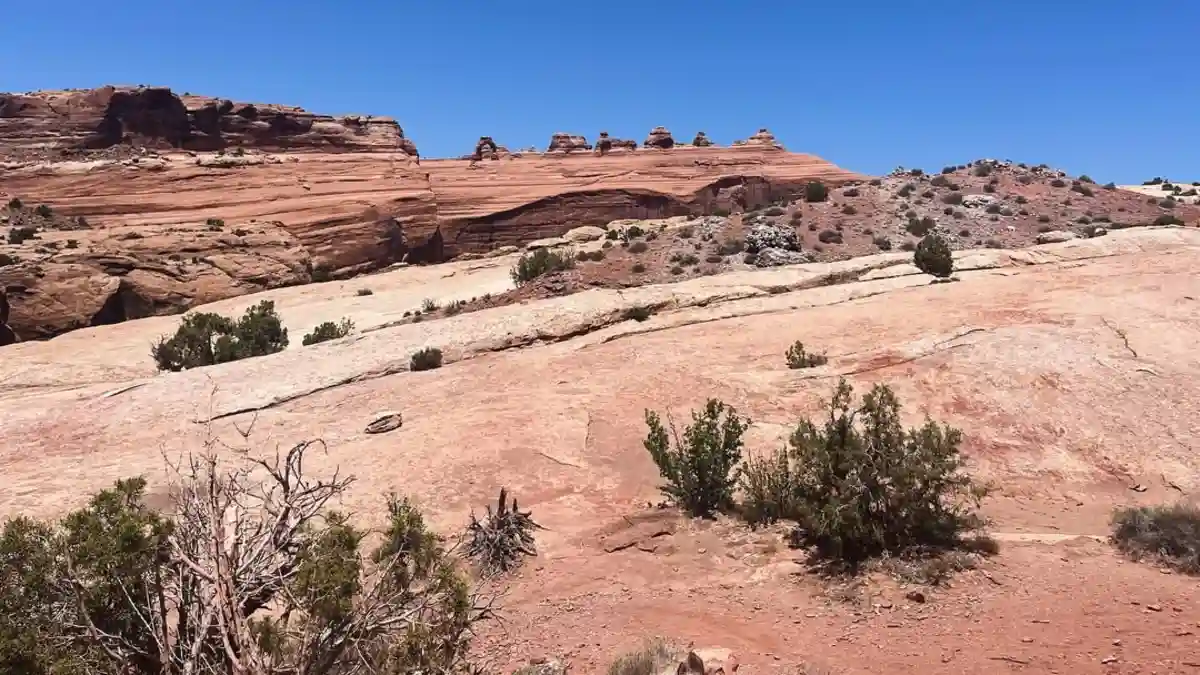
Why It’s Famous: This is more than a hike; it’s a trip to see the symbol of Utah. You’ve seen it on license plates and in photos.
The freestanding Delicate Arch is a world icon. The 3.2-mile trail to see it up close has become one of the most crowded walks in any national park.
The Proof: The number of visitors to Arches National Park grew by 74% between 2011 and 2021. This led the park to create a timed-entry reservation system to manage the crowds.
This system will be used for much of 2025, from April 1 to July 6 and August 28 to October 31, between 7 am and 4 pm. Even with this system, the park had almost 1.5 million visitors in 2022.
What Rangers Say: The NPS is very clear about the crowding problem. Park guides say the Delicate Arch parking lot is “usually full for much of the day.” They also say it’s “not uncommon for hundreds of people to visit Delicate Arch at sunset.”
A park study found that most visitors felt that more than 30 people at the arch was “unacceptable.” That number is now passed all the time.
What It’s Really Like: Bloggers and visitors say you have to “practice patience” and be careful not to hog the arch for photos. One visitor said they were “surrounded by hundreds and hundreds of people instead” of arches, which was a letdown.
Hike This Instead (Your 2025 Alternatives):
- Landscape Arch Trail: In the Devils Garden area, this easy 1.6-mile trail takes you to one of the longest natural arches in the world. For a quieter trip, you can keep going past Landscape Arch on the primitive trail to Double O Arch.
- Courthouse Wash Panel Trail: Called a “hidden gem,” this quiet 0.8-mile trail near the park entrance leads to ancient rock art. It offers a mix of “cultural history and desert solitude.”
- Delicate Arch Viewpoint Trail: If you still want to see the famous arch without the hard and crowded hike, this easy 0.5-mile option gives you a good, but far-off, view from across the canyon.
3. Devil’s Bridge Trail, Coconino National Forest, AZ
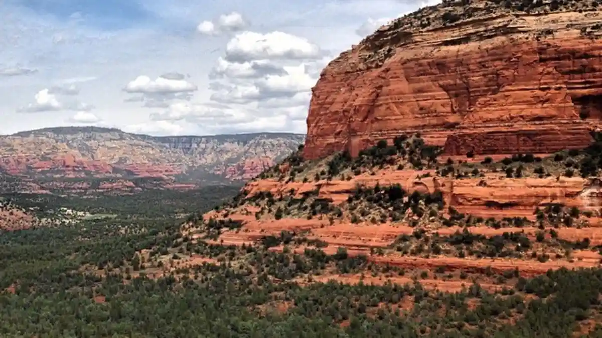
Why It’s Famous: Devil’s Bridge is a perfect example of an “Instagram-famous” hike. The goal—a photo of you standing on the biggest natural sandstone arch near Sedona—has become so popular that the hike is now all about long waits and crowds.
The Proof: While recent numbers are not complete, estimates from early 2021 showed 665 hikers a day, up from 459 in 2018. News reports from March 2024 confirm that the trail has seen a huge increase in visitors, especially since the pandemic.
What Rangers Say: Alex Schlueter, a ranger for the Coconino National Forest, says social media is the reason for the trail’s popularity. “It would be hard to make a case that [social media] hasn’t played a role,” he said.
“People see it and they want to come.” He confirmed seeing photos of “dozens of people waiting to take a photograph.”
What It’s Really Like: The experience is one of lines and traffic. Hikers say they wait anywhere from 15 minutes to over an hour just to get their picture on the bridge.
One hiker said it was like “going to Walmart on Black Friday.” A Reddit thread titled, “The line for Devil’s Bridge (AZ) photo op ,” says it all.
Hike This Instead (Your 2025 Alternatives):
- Vultee Arch Trail: This 5.1-mile hike leads to an arch that “looks similar to Devil’s Bridge, and you can walk on top of it, too.” The best part is the peace and quiet; you might have it all to yourself.
- Cathedral Rock Trail: This trail is also popular, but it’s a shorter (1.2 miles) and harder climb. It offers a more exciting adventure and gives you 360-degree views that are better than the single view at Devil’s Bridge.
- Chuck Wagon Trail: This trail is a prettier and “far less congested” way to get to the Devil’s Bridge area. It lets you skip the rough and often crowded 4×4 road that many people walk.
4. Skyline Loop Trail, Mount Rainier National Park, WA
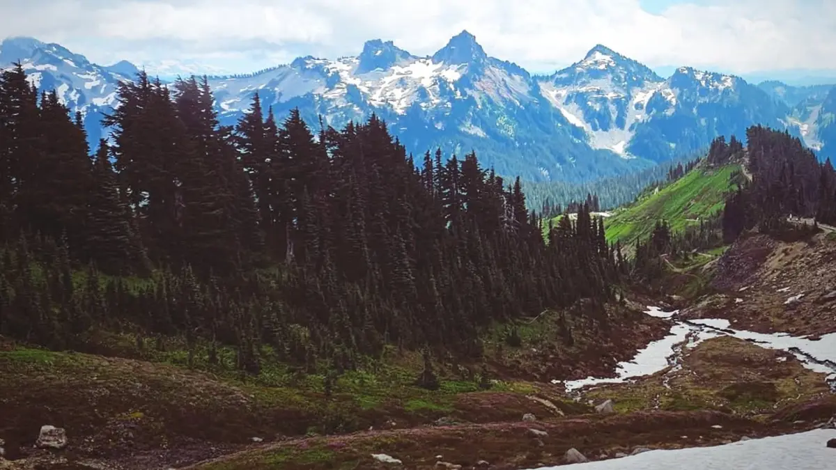
Why It’s Famous: This is the top day hike in Mount Rainier’s famous Paradise area. The Skyline Loop is known around the world for its amazing wildflower fields, glacier views, and closeness to the mountain’s top. This fame makes it the park’s “most popular destination.”
The Proof: The number of visitors to Mount Rainier National Park went up by 30% between 2008 and 2018. A huge 70% of those visitors came between June and September. The crowds in the Paradise area lead to major traffic jams.
What Rangers Say: While there are fewer direct quotes about the Skyline Loop, park-wide statements show the problem. Officials have talked about “hour-long waits to get into the park” and full parking lots that force people to park illegally on delicate plants.
A park ranger in a video points out several easier, shorter trails in Paradise as other options. This is a quiet admission that the main loop is too crowded.
What It’s Really Like: Trip reports confirm the mess. The main parking lot at Paradise “will almost certainly be full by 9:00am on weekend mornings in the summer,” and often on weekdays too.
One hiker said the trail is a place where “everyone and their grandma are out there giving it a try.” They said it “felt like Bierstadt on a Saturday”—a very crowded Colorado mountain.
Hike This Instead (Your 2025 Alternatives):
- Mount Fremont Lookout Trail (Sunrise Area): Found in the often quieter Sunrise area on the park’s east side, this moderate 5.6-mile hike offers “one of the best vantage points of Mt. Rainier” and a chance to see an old fire lookout.
- Pinnacle Peak Trail (Paradise Area): If you are set on the Paradise area, this shorter (2.5 miles) but steeper hike is “popular (but not too crowded).” It gives you amazing views of Mount Rainier from across the valley.
- Tolmie Peak Fire Lookout Trail (Mowich Lake Area): This moderate 5.5-mile hike in the quiet northwest corner of the park “isn’t as popular as some of the other hikes.” It leads to a great view of the mountain reflected in Eunice Lake.
5. Navajo Loop and Queens Garden Trail, Bryce Canyon National Park, UT
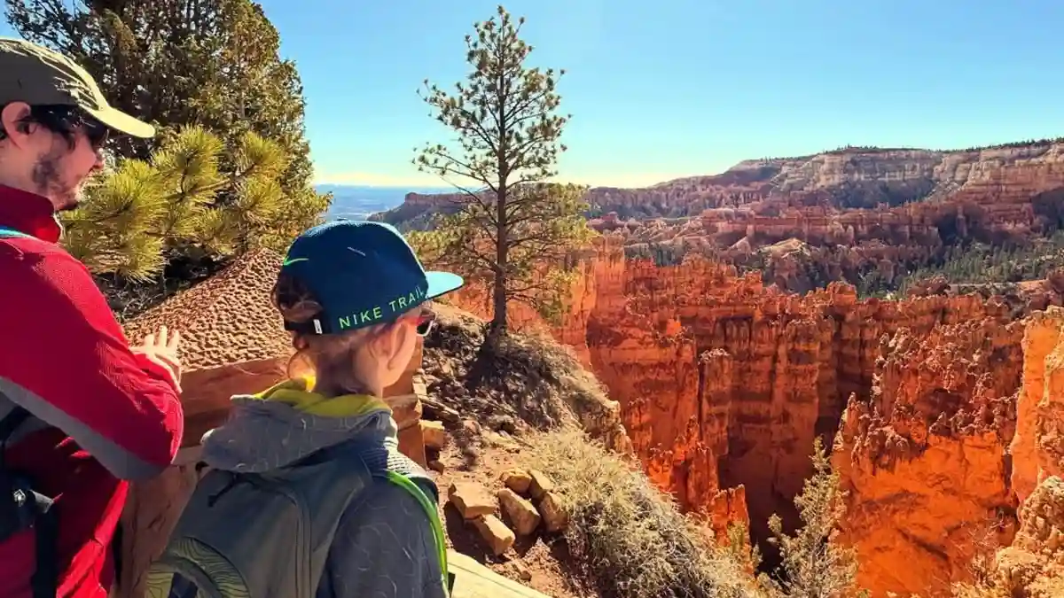
Why It’s Famous: This 2.9-mile loop is the classic Bryce Canyon hike. It takes you down from the rim to walk among the world’s biggest collection of hoodoos. Its famous status and easy difficulty make it the most popular—and crowded—hike in the park.
The Proof: Bryce Canyon gets fewer visitors than Zion (over 2.1 million in 2021), but the park is small. This means most visitors go to the main amphitheater, making this specific loop feel very crowded.
What Rangers Say: Official park videos and guides point to the Navajo Loop and Queens Garden trails as the main Bryce experience, which sends a lot of traffic there. The NPS trail page tells visitors to check when parking lots are busiest, showing the high demand.
What It’s Really Like: The experience is often a human traffic jam. The famous “Wall Street” part of the Navajo Loop has been called a “circus,” with “endless tour groups” and people climbing on fragile rocks for selfies.
Social media posts and blogs warn that even at sunrise, you can “expect to share the viewpoint with a hundred other people.” They also say the trail is “packed with tons of visitors.”
Hike This Instead (Your 2025 Alternatives):
- Fairyland Loop Trail: A longer (7.9 miles) and harder hike that is often suggested as the best way to find peace in Bryce. It has amazing hoodoo views but “hardly any crowds.” One visitor said it had “30x fewer people” than the main loops.
- Peekaboo Loop Trail: This hard 5.2-mile loop is another great choice to “get away from the crowds.” It offers great views with much less foot traffic than the Navajo/Queens Garden combo.
- Bristlecone Loop Trail: Found at the far southern end of the scenic drive, this easy 1.3-mile trail goes through an old bristlecone pine forest. It offers a very different and much quieter experience than the main amphitheater.
6. Angels Landing, Zion National Park, UT
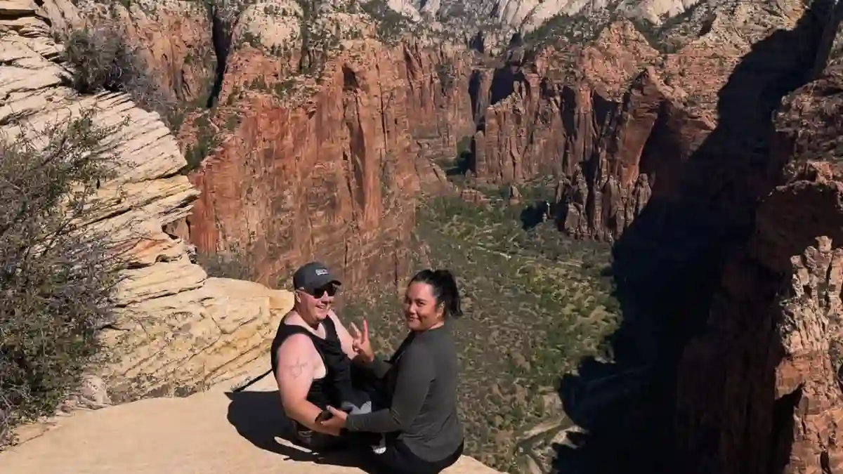
Why It’s Famous: Angels Landing is one of the most famous and exciting hikes in the world. The final climb along a narrow spine with chains to hold onto is a must-do for adventurers.
Its huge popularity, however, led to dangerous crowding. Now, a strict permit system is needed to manage the number of hikers.
The Proof: Zion is one of America’s most visited national parks, with over 4.9 million people in 2024. The permit system, started in 2022, was a direct answer to the dangerous traffic jams on the chain section.
The lottery for 2025 is already set up, with seasonal and day-before options that cost $6 to apply. This shows the high and managed demand.
What Rangers Say: Susan McPartland, a manager at Zion, explained that the permit system was for both safety and the visitor experience. Before the system, “people were so focused on making their way up the trail that they didn’t have those moments just to stop, enjoy the scenery.”
What It’s Really Like: Even with the permit system, the hike is not a quiet one. One blogger said, “Honestly, I don’t think the Angel’s Landing hike is worth it… because of the crowds. They are horrendous.
The trail has been loved to death.” Online forums are full of talks about how to time a hike to avoid the worst of the shuttle lines and trail traffic, even with a hard-to-get permit.
Hike This Instead (Your 2025 Alternatives):
- Scout Lookout: This is the spot right before the permitted chain section of Angels Landing. It offers “90 percent of the journey” and a “nearly identical” view down Zion Canyon. You don’t need a permit or have to face the dangerous heights. It is the perfect alternative if you want the classic trail experience.
- Observation Point (via East Mesa Trail): Many call this the “single best view in the park.” This spot offers an amazing bird’s-eye view down on Angels Landing. The current way to get there is via the East Mesa Trail. It’s a moderate and mostly flat 7-mile round trip that starts outside the park’s east entrance.
- Canyon Overlook Trail: A short, easy-to-moderate 1-mile round-trip trail that “delivers a view that rivals many longer hikes.” This makes it the best option for “reward for your effort” and a great, easy alternative.
7. Half Dome, Yosemite National Park, CA
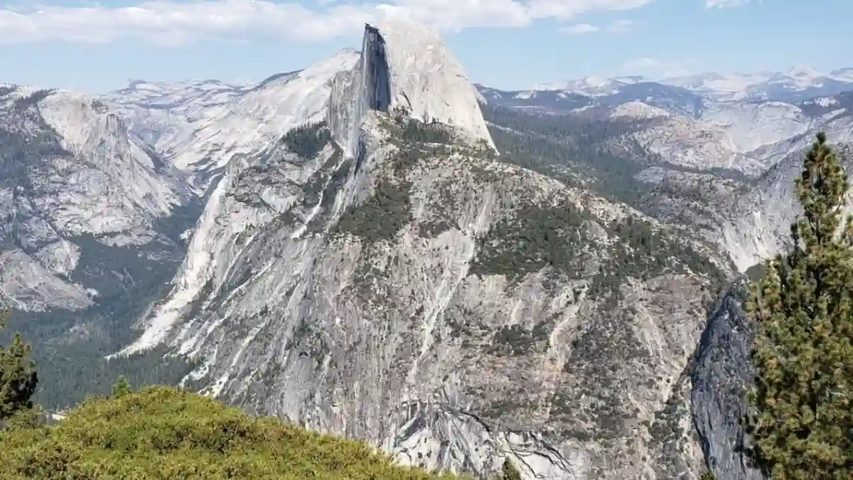
Why It’s Famous: The climb up Half Dome is the biggest Yosemite challenge. It’s a famous granite rock, and the final 400-foot climb up the cable route is a legendary—and now very exclusive—hike.
The Proof: The huge demand for this hike is shown by the permit lottery numbers. The system only allows 300 hikers per day (225 day hikers and 75 backpackers). In 2023, the success rate for the preseason lottery was only 17%.
The daily lottery was a little better at 19%. With over 4.2 million visitors to Yosemite in 2024, the pressure on this one trail is huge.
What Rangers Say: Public comments during the planning for Half Dome show deep worries from both visitors and officials. The experience on the cables was described as feeling like “Disneyland, and not a park.”
The crowding created a dangerous situation as hikers pushed for space on the steep rock face.
What It’s Really Like: The lottery’s low success rate creates a mental pressure. People who win a permit might feel they have to try the hike even in unsafe, wet weather, because they might not get another chance.
The “Disneyland-like atmosphere” refers to the loss of a wild feeling when a hard climb becomes a crowded line.
Hike This Instead (Your 2025 Alternatives):
Upper Yosemite Falls Trail:
A hard 6.6-mile hike that is one of the park’s oldest and toughest trails. It gives you a similar feeling of a big physical achievement.
It rewards you with amazing, up-close views of North America’s tallest waterfall and wide views of Yosemite Valley.
Sentinel Dome and Taft Point Loop:
This moderate 5.1-mile loop along Glacier Point Road gives you some of the most amazing wide views in the park.
This includes a stunning view of Half Dome from across the valley. It gives you the famous views without the permit lottery or huge crowds.
- Vernal and Nevada Falls via the Mist Trail:
This hard 6.2-mile hike is part of the same trail used for Half Dome. - You can feel the iconic, wet spray of the Mist Trail’s stone steps and the loud power of two of Yosemite’s most famous waterfalls. You get much of the same scenery without needing a Half Dome permit.
| Instead of This Crowded Trail… | Try This Alternative… | Location | Difficulty & Length | Why It’s a Great Choice |
| Avalanche Lake (Glacier NP) | Johns Lake Loop | West Glacier, MT | Easy, 2 mi. | A quiet, marshy lake experience away from the main road crowds. |
| Delicate Arch (Arches NP) | Landscape Arch Trail | Devils Garden, UT | Easy, 1.6 mi. | See one of the world’s longest arches with options for more quiet on primitive trails beyond. |
| Devil’s Bridge (Coconino NF) | Vultee Arch Trail | Sedona, AZ | Moderate, 5.1 mi. | A similar arch you can walk on, but with a high chance of having it all to yourself. |
| Skyline Loop (Mt. Rainier NP) | Mt. Fremont Lookout Trail | Sunrise Area, WA | Moderate, 5.6 mi. | Offers arguably better, wider views of Rainier from the less-crowded Sunrise area. |
| Navajo/Queens Garden (Bryce NP) | Fairyland Loop Trail | North Amphitheater, UT | Moderate, 7.9 mi. | The best trail in Bryce for quiet, with amazing hoodoos and “30x fewer people.” |
| Angels Landing (Zion NP) | Observation Point (via East Mesa) | East Zion, UT | Moderate, 7 mi. | Gives you a better, wide view down on Angels Landing with no permit and fewer people. |
| Half Dome (Yosemite NP) | Sentinel Dome & Taft Point Loop | Glacier Point Rd, CA | Moderate, 5.1 mi. | Gives you famous, sweeping views of Yosemite Valley and Half Dome without the permit or danger. |